• Skip to primary navigation
  • Skip to main content
  • Skip to footer
appalachian citizens law center logo

Appalachian Citizens' Law Center

We Fight for Justice in the Coalfields

  • Who We Are
    • About Us
    • Staff & Board
    • Internships & Fellowships
    • Job Openings
    • Contact
    • Financials
  • What We Do
    • Environmental Justice
    • Miners’ Health & Safety
    • Policy & Research
    • Advocacy
  • Get Help
    • Federal Black Lung Benefits
    • Black Lung Associations
    • Environmental Problems
    • Mine Safety Discrimination
  • Take Action
  • News
  • DONATE

Flood Mapping for Appalachia

December 4, 2024 Advocacy, Environmental, Flooding

By Jessica Arriens, National Wildlife Federation

This blog is part of a series detailing the flood resilience policy roadmap for Appalachia, released by ReImagine Appalachia, Appalachian Citizens’ Law Center and the National Wildlife Federation

Across many parts of the U.S., flooding is becoming more frequent and more severe due to climate change. Which means flood maps, which show a community’s flood risk, are becoming more important tools for homeowners, businesses, and government officials.

Federal investments in flood mapping, however, have not kept pace with the need or with increasing climate impacts. Thousands of U.S. communities lack maps, and about 15 percent of community flood maps are over 15 years old. More expansive and accurate maps are needed, particularly in communities across Appalachia, a region uniquely vulnerable to climate-induced flooding.

Besides providing crucial information to inform local development and emergency planning, flood maps determine requirements for flood insurance. The National Flood Insurance Program (NFIP) requires the Federal Emergency Management Agency (FEMA) to update and maintain flood maps with respect to all populated areas and areas of population growth within 100-year and 500-year floodplains.

FEMA uses a mix of data sources from federal and state agencies, local development districts, and more to create its flood maps. The maps don’t always reflect the best available climate science or current climate impacts – especially the extreme rainfall events seen increasingly in Appalachia. A 2020 report from the nonprofit flood risk group First Street Foundation identified nearly 15 million properties with a substantial risk of flooding, which is nearly 68 percent higher than the number of properties identified by FEMA. First Street used flooding from multiple sources (including rainfall and riverine), plus current and future environmental considerations, to calculate substantial flood risk. That inclusion of flood risk from rainfall helped drive the higher number of at-risk properties. According to First Street, 45 percent of the parcels in the four counties that were most impacted by the July 2022 flooding disaster in Eastern Kentucky had a very high risk of flooding, but only 22 percent of those parcels were in a FEMA-designated flood zone.

15358867302 0e1b1c1220 c
A USGS streamgage on Virginia’s Little Back Creek. Credit: Alan Cressler, USGS

Earlier this year, NWF, Appalachian Citizens’ Law Center (ACLC), and ReImagine Appalachia released a flood resilience policy roadmap for Appalachia. The platform highlights the unique flooding challenges the entire region faces, and details four sets of policy recommendations to improve Appalachian communities’ ability to respond to and recover from floods. It covers recommendations on ways to improve flood mapping and data inputs, including:

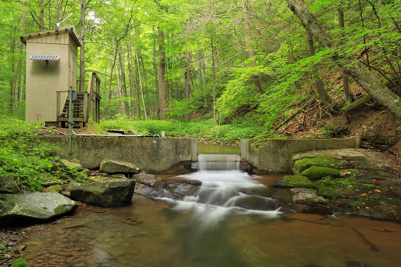
  • Deploy more streamgages in Appalachia. One of the key data sources used to create flood maps comes from the U.S. Geological Survey’s (USGS) streamgage network. This network is essential to ensure that communities are warned in time to evacuate areas affected by flooding. Flood alerts and predictions generated by the National Weather Service rely on data generated from USGS-managed streamgages. Streamgages can send alerts to residents to directly notify them of rising stream or water levels. And streamgage data can inform long-term resilience planning. Increasing funding for USGS would enable the agency to deploy additional streamgages, including in rural and disadvantaged communities. 
  • Modernize and expand FEMA floodmaps, so communities can know their accurate flood risk. Updated maps should account for anticipated climate impacts, and incorporate mapping of existing natural floodplain areas to understand where protective natural features exist and where they have been lost.

Learn more about the flood resilience policy roadmap for Appalachia here. 

Join a webinar with NWF, Appalachian Citizens’ Law Center, and ReImagine Appalachia to learn more about our coalition’s flood resilience priorities for Appalachia on December 12 from 12-1 p.m. ET. Register here.

Footer

Appalachian Citizens' Law Center

317 Main St, Whitesburg, KY 41858

(877) 637-3929 Toll Free

(606) 633-3929

© Addison Williams Hero Image

Recent Posts

  • Amid Chaos Caused by Funding Cuts, Layoffs, and Policy Rollbacks, Appalachian Leaders Release Appropriations Priorities for Congress
  • Assault on Coal Miners Continues as MSHA Halts Enforcement of Life-Saving Silica Dust Safeguard
  • ANNOUNCEMENT: ACLC Welcomes Caroline Rubens As New Fundraising Officer
  • Our statement on the dismantling of the National Institute of Occupational Health and Safety
  • Advocates Call on Congress to Make Sure Coal Companies Don’t Skip Out on Black Lung Responsibilities

Recent Comments

    Archives

    • May 2025
    • April 2025
    • March 2025
    • February 2025
    • December 2024
    • September 2024
    • August 2024
    • June 2024
    • May 2024
    • April 2024
    • March 2024
    • February 2024
    • January 2024
    • October 2023
    • September 2023
    • August 2023
    • June 2023
    • April 2023
    • March 2023
    • February 2023
    • January 2023
    • December 2022
    • November 2022
    • October 2022
    • September 2022
    • August 2022
    • July 2022
    • June 2022
    • May 2022
    • April 2022
    • March 2022
    • January 2022
    • December 2021
    • November 2021
    • October 2021
    • September 2021
    • August 2021
    • July 2021
    • June 2021
    • May 2021
    • April 2021
    • March 2021
    • February 2021
    • January 2021
    • December 2020
    • November 2020
    • October 2020
    • September 2020
    • August 2020
    • July 2020
    • June 2020
    • May 2020
    • April 2020
    • March 2020
    • February 2020
    • January 2020
    • November 2019
    • October 2019
    • September 2019
    • August 2019
    • July 2019
    • June 2019
    • May 2019
    • April 2019
    • March 2019
    • February 2019
    • January 2019
    • December 2018
    • November 2018
    • October 2018
    • June 2018
    • May 2018
    • April 2018
    • January 2018
    • June 2017
    • May 2017
    • December 2016
    • November 2016
    • October 2016
    • September 2016
    • August 2016
    • February 2016
    • January 2016
    • December 2015
    • October 2015
    • September 2015
    • August 2015
    • July 2015
    • June 2015
    • February 2015
    • December 2014
    • November 2014
    • October 2014
    • September 2014
    • August 2014
    • July 2014
    • June 2014
    • May 2014
    • April 2014
    • March 2014
    • February 2014
    • January 2014
    • December 2013
    • July 2013
    • June 2013
    • May 2013
    • April 2013
    • March 2013
    • February 2013
    • January 2013
    • December 2012
    • October 2012
    • September 2012
    • August 2012
    • July 2012
    • June 2012
    • May 2012
    • April 2012
    • February 2012
    • September 2011
    • August 2011
    • May 2011
    • February 2011
    • January 2011
    • September 2010
    • August 2010
    • July 2010
    • June 2010
    • May 2010
    • April 2010
    • February 2010
    • January 2010
    • January 1970

    Categories

    • Abandoned Mine Lands
    • ACLC News
    • Advocacy
    • Bankruptcy
    • Black Lung
    • Case Study
    • COVID-19
    • Environmental
    • Flooding
    • Just Transition
    • Justice
    • Mine Safety
    • Press Release
    • Uncategorized
    • Water

    Meta

    • Log in
    • Entries feed
    • Comments feed
    • WordPress.org
    • Who We Are
      • About Us
      • Staff & Board
      • Internships & Fellowships
      • Job Openings
      • Contact
      • Financials
    • What We Do
      • Environmental Justice
      • Miners’ Health & Safety
      • Policy & Research
      • Advocacy
    • Get Help
      • Federal Black Lung Benefits
      • Black Lung Associations
      • Environmental Problems
      • Mine Safety Discrimination
    • Take Action
    • News
    • DONATE

    Sitemap

    Copyright © 2025 Appalachian Citizens' Law Center

    We use cookies to ensure that we give you the best experience on our website. If you continue to use this site we will assume that you are happy with it.Ok